Ssese Islands: Lake Victoria Geography, Islands & Uganda Location
The Ssese Islands are an archipelago in the northwestern part of Lake Victoria, within Uganda.

Ssese Islands, Uganda.
- Country
- Uganda
- Coordinates
- 0.4333° S, 32.2500° E
- Lake
- Lake Victoria
- Administrative area
- Kalangala District
Short answer
Where are the Ssese Islands?
The Ssese Islands are an archipelago in the northwestern part of Lake Victoria, within Uganda.
They are part of Kalangala District and are known for lake-island geography, forested landscapes, fishing communities, and ferry-linked settlements.
Country: Uganda
Lake: Lake Victoria
Administrative area: Kalangala District
Type: Lake archipelago
Region: Northwestern Lake Victoria
Known for: Forested islands, lake transport, fishing, and tourism
See the answer as a place
An archipelago is more than one island
The visual makes the defining geographic relationship clear: many forested islands distributed through Lake Victoria.
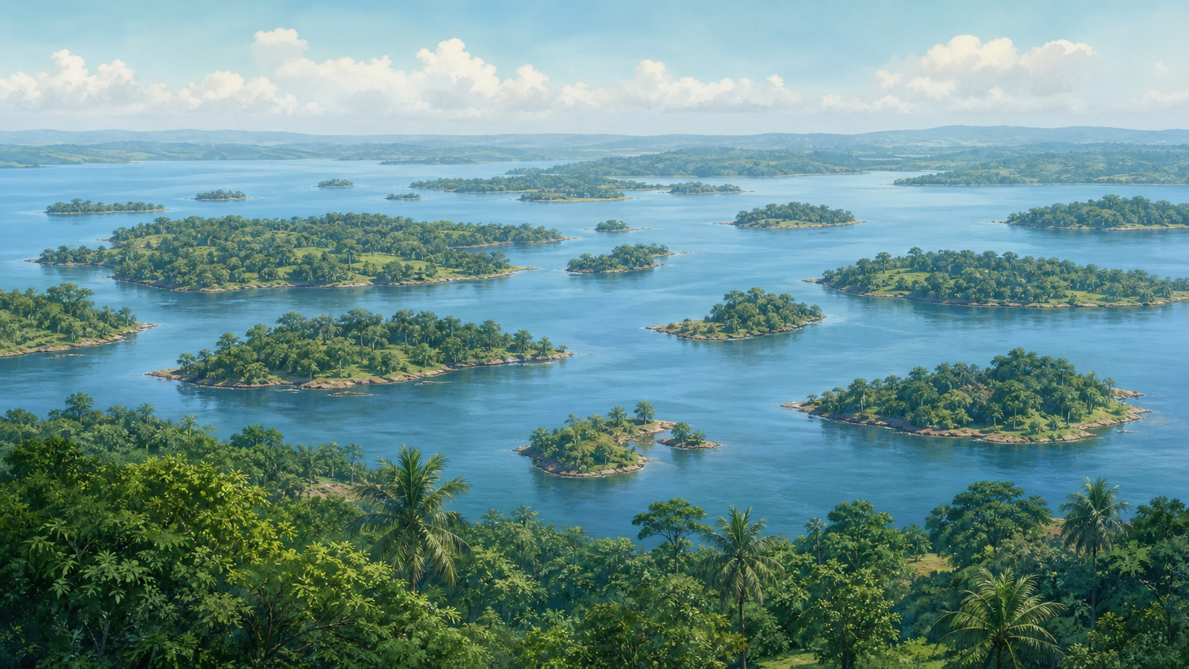
- The scattered island pattern
- Channels of freshwater between the islands
- The forested lake-shore landscape
Ssese Islands overview
The Ssese Islands are an archipelago of 84 islands in Lake Victoria, in Uganda's Central Region. Located in the lake's northwestern sector off Uganda's southern shore, the islands form the core of Kalangala District and include inhabited and uninhabited landmasses with freshwater habitats, fishing economies, and cultural associations with the Buganda kingdom.
Ssese Islands location in Lake Victoria
The Ssese Islands sit in Lake Victoria, not in the ocean. Their location makes them a useful reference point for searches about Uganda's lake geography and island communities.
Kalangala, the main island district, links the islands to Uganda's lake transport, fishing economy, and tourism geography.
Ssese Islands coordinates
Ssese Islands is commonly mapped at approximately 0.4333° S, 32.2500° E, or -0.4333, 32.2500 in decimal degrees.
Degrees: 0.4333° S, 32.2500° E
Decimal: -0.4333, 32.2500
Where Ssese Islands is located
The Ssese Islands are in the northwestern quadrant of Lake Victoria, off the southern shore of Uganda's Central Region. Administratively the archipelago forms the bulk of Kalangala District, a district composed primarily of islands rather than mainland territory. Coordinates for the central cluster are near 0.3 degrees south latitude and 32.2 degrees east longitude, placing the islands west of the Entebbe peninsula and east of the Tanzanian lake boundary. This location is characterized by shallow lake basins, papyrus-lined bays, and vegetated shorelines.
Why Ssese Islands is important
Ssese Islands history encompasses regional fisheries, freshwater ecosystems, and cultural connections to the Buganda kingdom. The archipelago supports commercially important fish species, including Nile perch and tilapia, and contains mangrove and papyrus habitats that contribute to fish nursery functions and bird habitat. Certain islands are associated with traditional landing and ritual activities in Buganda oral traditions, while scientific surveys have identified several islands as important freshwater research sites.
History of Ssese Islands
The islands formed as part of the Lake Victoria basin, with topography shaped by lacustrine processes that produced shallow soils and shoreline wetlands. Pre-colonial lake trade used the islands as transshipment points for dried fish and other goods moving across Lake Victoria. Human settlement developed through successive waves of Nilotic and Bantu-speaking communities, and the archipelago entered the cultural sphere of the Buganda kingdom, where islands served seasonal and ritual roles. Colonial administration introduced cash-crop ventures and mission stations that altered land use on larger islands. Fishing later intensified, accompanied by population shifts and changes in forest cover on some islands. Local leadership and district governance subsequently formalized island administration within Uganda's national framework.
Natural features of Ssese Islands
The Ssese Islands display low rolling hills, forest patches, inland swamps, and sheltered bays characteristic of shallow lake archipelagos. Bugala Island is the largest landmass and contains the greatest extent of continuous woodland within the group. Shorelines include narrow sandy beaches alternating with papyrus and reed fringes that function as wetland margins. Geologically the islands are composed of sedimentary deposits and lacustrine sands with shallow soils that support secondary forests and small cultivated plots. Human-built elements include dispersed village clusters, timber structures using local materials, and remnants of colonial-era plantation infrastructure.
Environment, protection, and monitoring of Ssese Islands
Ssese Islands are administered under Kalangala District and fall under Uganda's national environmental legislation and sector agencies for fisheries and forestry. Conservation themes emphasize freshwater biodiversity, wetland protection, and sustainable fisheries management reflected in district planning and research efforts. Local institutions, university researchers, and non-governmental organisations have documented habitats, conducted monitoring, and advised on mangrove and papyrus conservation measures. Long-term management focuses on coordination between district governance and national agencies to balance resource use with ongoing habitat monitoring and record-keeping in fisheries and land-use documents.
Ssese Islands facts
- Pre-colonial lake trade used the islands as transshipment points for dried fish and other goods moving across Lake Victoria.
- Island topography varies from tiny rocky islets to larger vegetated landmasses, with area ranges spanning under one hectare to several square kilometers.
- Luganda and related local dialects are widely spoken across inhabited islands, reflecting enduring cultural ties to the Buganda kingdom.
- Isolated woodland remnants on certain islands support plant assemblages that differ from nearby mainland vegetation.
- The archipelago forms the principal territory of Kalangala District, an administrative district composed predominantly of islands.
More in Uganda
Related places to Ssese Islands
Explore nearby pages and closely connected places to keep navigating within the same geography cluster.
Explore Places by Type
Browse structured collections of recently published places by institution, urban role, or transport type.
Frequently Asked Questions
Where are the Ssese Islands located?
The Ssese Islands are located in Lake Victoria in Uganda.
Are the Ssese Islands in Uganda?
Yes. The Ssese Islands are part of Uganda and are administered mainly through Kalangala District.
What lake are the Ssese Islands in?
The Ssese Islands are in Lake Victoria.
What are the Ssese Islands known for?
They are known for lake-island landscapes, forested areas, fishing communities, ferry routes, and tourism on Lake Victoria.
What are the coordinates of Ssese Islands?
Ssese Islands is commonly mapped at approximately 0.4333° S, 32.2500° E, or -0.4333, 32.2500 in decimal degrees.