Zimbabwe Guide
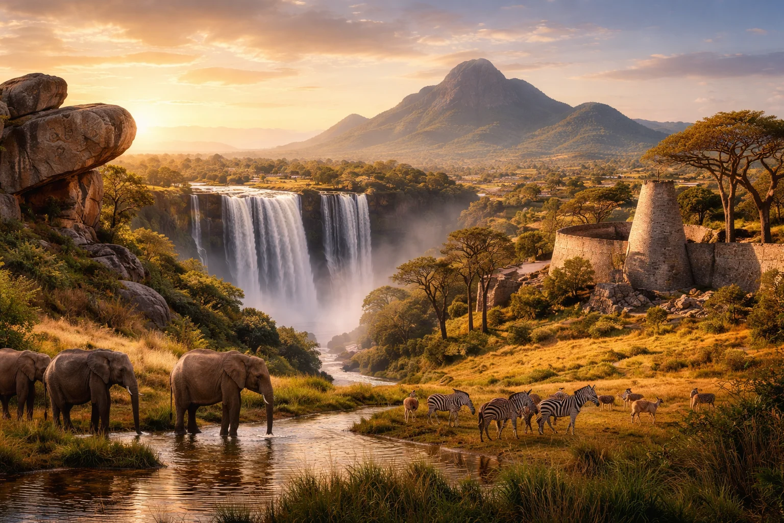
Zimbabwe overview
Zimbabwe is a landlocked country in southern Africa named after the medieval stone complex of Great Zimbabwe, whose ruins provide the modern nation’s name and a continuing cultural reference point. Straddling a high central plateau, Zimbabwe combines mineral-rich geological features with a history of centralized precolonial states and dramatic 20th-century political change. Its significance stems from distinctive archaeological heritage, an economy shaped by large-scale mining and smallholder agriculture, and a plural linguistic landscape anchored by Shona and Ndebele traditions. Zimbabwe’s institutions and landscapes reflect those layered legacies.
Common Geography Questions About Zimbabwe
Where Zimbabwe is located
Zimbabwe sits in southern Africa, centered roughly near 19°S latitude and 29°E longitude, and occupies territory between the Zambezi River to the north and the Limpopo River to the south. It is landlocked, bordering Zambia to the northwest, Mozambique to the east, South Africa to the south, and Botswana to the southwest. The Zambezi forms part of the northern boundary and includes the man-made Lake Kariba reservoir; the country’s position astride major river catchments defines its transport and ecological links despite lacking a coastline. Zimbabwe’s inland location shapes its regional role.
Geography and landscape of Zimbabwe
Zimbabwe’s terrain is dominated by a 1,200–1,500 m central plateau known as the Highveld, punctuated by the north-south Great Dyke, a linear ultramafic ridge unique for hosting layered mineral deposits. The Eastern Highlands rise to Mount Nyangani, the country’s highest point, and create an east–west rainfall gradient where humid slopes contrast with semi-arid lowlands. The Matobo Hills’ granite kopjes and balancing rocks form a geological signature distinct to Zimbabwe, while the Zambezi River cuts dramatic gorges at Victoria Falls on the northern edge. Regional variation is therefore steep and geologically specific.
Zimbabwe culture and society
Zimbabwe’s social fabric centers on Bantu-speaking communities, with Shona and Ndebele as the dominant cultural-linguistic groups alongside English used in government and commerce; the constitution recognizes multiple other indigenous languages. Cultural distinctives include the mbira lamellophone tradition used in spirit-medium ceremonies, and a widely recognized Shona stone-sculpture movement that draws on local hard stone. Religious life mixes Christianity with ancestral veneration and spirit mediumship in ways that structure communal land use and ritual calendars. Urban migration patterns and extended kin networks shape contemporary demographic dynamics.
History of Zimbabwe
The territory of present-day Zimbabwe was home to the Kingdom of Great Zimbabwe from around the 11th century, whose monumental dry-stone architecture anchored regional trade in gold and ivory. Successor states, including the Mutapa polity, engaged with Indian Ocean trade before European colonization brought rule by the British South Africa Company and, later, southern Rhodesian settler governance. The 20th century saw a transition from settler rule to majority independence in 1980 after armed struggle and negotiation; subsequent decades featured contested land reform and economic upheaval that reshaped agrarian structures and international relationships. These long arcs link precolonial statecraft to modern governance.
Zimbabwe economy and government
Zimbabwe is a unitary presidential republic with a constitutionally defined executive president and a bicameral Parliament (Senate and National Assembly). The economy combines extractive industries—notably artisanal and industrial mining of gold, diamonds (including the Marange fields), and other minerals—with commercial and smallholder agriculture where tobacco and maize have been major crops. The country experienced severe monetary instability in the 2000s that led to abandoning the sole use of the Zimbabwean dollar and atypical multi-currency arrangements; informal economic activity and remittances also play outsized roles in livelihoods. State enterprises coexist with private and informal sectors.
Regions and major cities of Zimbabwe
Administratively, Zimbabwe is divided into ten provinces plus two cities that hold provincial status. Harare is the national capital and administrative center; Bulawayo is the principal inland industrial city; Mutare sits at the foot of the Eastern Highlands near the Mozambique frontier. Other urban nodes include Gweru and Masvingo. Regionally, historical provinces such as Mashonaland, Matabeleland and Manicaland denote cultural and ecological distinctions—Mashonaland’s plateau agriculture contrasts with Matabeleland’s drier landscapes and distinct Ndebele cultural presence.
Distinctive characteristics of Zimbabwe
Zimbabwe is globally associated with a few concrete features: the Great Zimbabwe stone ruins that gave the country its name and are inscribed as a UNESCO World Heritage Site; the Great Dyke’s unique linear mineral belt that underpins important platinum-group metal reserves; and the cultural export of Shona stone sculpture and mbira music found in international collections and ethnomusicology studies. The Kariba Dam’s reservoir is one of the world’s large artificial lakes by volume, and the country’s colonial-to-postcolonial land reforms remain a reference case in comparative studies of agrarian change.
Places in Zimbabwe
Balancing Rocks
Balancing Rocks is a set of distinctive granite rock formations on the eastern outskirts of Harare, Zimbabwe, noted for perched boulder silhouettes. The site comprises multiple rounded blocks that measure several metres across and rise conspicuously above surrounding low kopjes. Geomorphologists regard Balancing Rocks as an instructive example of spheroidal weathering on coarse-grained granite. The formations have cultural recognition within Zimbabwe and are frequently cited in studies of inselberg and tors development.
Chinhoyi Caves
Chinhoyi Caves is a karst cave complex in Mashonaland West Province, Zimbabwe, known for a deep, clear limestone pool called the Sleeping Pool. The site has formal protected-area status under Zimbabwe’s national park system, which defines its legal conservation framework. The caves are significant for scientific speleology, local cultural associations, and distinct groundwater features that have been documented and measured by geological and diving expeditions.
Eastern Highlands
Eastern Highlands is a mountain range and highland region in eastern Zimbabwe, noted for montane landscapes and biodiversity. The region rises to Mount Nyangani, Zimbabwe’s highest peak at 2,592 meters above sea level. Its location anchors major eastern river headwaters and its significance rests on both ecological values and long-term water supply functions. The highlands contain formal protected areas and distinct geological formations, making them a focal point for studies of montane ecosystems and regional land management.
Great Zimbabwe Ruins
Great Zimbabwe Ruins is a ruined medieval city site in southeastern Zimbabwe notable for its dry-stone architecture and complex layout. The archaeological site lies near the modern town of Masvingo and formerly functioned as a regional political and economic center. It is the largest known precolonial stone-built settlement in southern Africa and a central reference point in the region's history. A measurable architectural fact is that some of its dry-stone walls exceed ten meters in preserved height.
Harare
Harare is the capital and largest city of Zimbabwe, serving as the country's principal political and economic center. The city functions as the national seat of government and hosts central financial institutions and major cultural organizations. It holds formally defined status as a provincial-level municipality under Zimbabwean law with a municipal council and metropolitan administration. This combination of administrative authority and urban scale makes it the primary locus for national governance and demographic reference.
Harare Gardens
Harare Gardens is a municipal urban park in central Harare, Zimbabwe, designated and managed as municipal parkland by Harare City Council. The park functions as a principal green space within the city’s central business district and contains mature trees, formal planting areas, and open lawns. Harare Gardens represents an enduring element of Harare’s urban form and municipal green infrastructure, providing structured public landscape and horticultural display areas under local government responsibility.
Hwange National Park
Hwange National Park is a protected wildlife reserve in northwestern Zimbabwe and the country's largest national park by area. The park covers approximately 14,600 square kilometres and supports diverse savanna and woodland ecosystems. It is significant for sustaining one of southern Africa's largest populations of African savanna elephants and for its role in regional biodiversity conservation. Hwange National Park serves as a benchmark landscape for ecological research and long-term wildlife management in Zimbabwe.
Lake Kariba
Lake Kariba is a large artificial reservoir on the Zambezi River, located along Zimbabwe’s northern border with Zambia. Created by Kariba Dam, it covers roughly 5,580 square kilometres and extends about 223 kilometres along the river valley, ranking among the largest man-made lakes by surface area. Its hydroelectric complex and major inland fishery underpin the reservoir’s regional economic importance, while its engineered ecosystem remains a focus of scientific study.
Mana Pools
Mana Pools is a floodplain wildlife reserve and national park on the lower Zambezi River in northern Zimbabwe, significant for its intact riverine ecosystems and large mammals. The protected area covers about 2,200 square kilometres and is internationally recognized for its river channels, oxbow lakes, and wildlife concentrations. Mana Pools is notable both as a center for ecological research into floodplain dynamics and as a formally designated World Heritage property for natural values.
Matobo Hills
Matobo Hills is a granite hill complex and cultural landscape in southwestern Zimbabwe, celebrated for its dense concentrations of rock art and distinctive kopje formations. The area lies at the core of Matobo National Park and contains more than 3,000 documented rock art sites, a measurable concentration of hunter-gatherer paintings. The location is significant for its combined archaeological, spiritual and geological values. Its features integrate tangible cultural heritage, unique landforms and important wildlife habitats into a single protected landscape.
Natural History Museum of Zimbabwe
Natural History Museum of Zimbabwe is a national natural-history museum in Zimbabwe. It is sited in Bulawayo and functions under the National Museums and Monuments of Zimbabwe as a state institution responsible for long-term curation of zoological, geological, and palaeontological collections. The museum maintains permanent exhibition galleries and on-site research and conservation laboratories that together form its measurable institutional footprint within the city’s civic precinct.
University of Zimbabwe
University of Zimbabwe is a public university in Zimbabwe, founded as a higher-education institution in 1952. The university serves as Zimbabwe’s oldest degree-granting institution and functions as a national center for tertiary education, research, and professional training. Its principal campus in Mount Pleasant, Harare, houses the main administrative offices, central library collections, and several colleges, and the university operates under statutes administered by a governing council and an academic senate.