Tanzania Guide
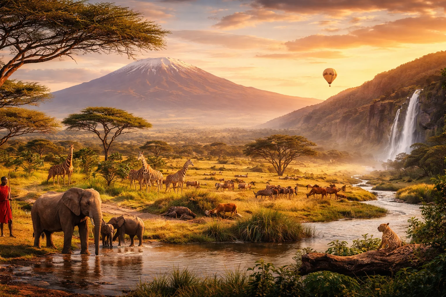
Tanzania overview
Tanzania is an East African country occupying a broad swath of the continent’s eastern flank. It is the largest country in the East African region by land area and combines mainland territory with offshore islands, giving it both long Indian Ocean frontage and freshwater lake shores. The nation is known for a rare convergence of assets: major archaeological sites that shaped our understanding of human origins, extensive protected wildlife ecosystems, and a national language that functions across ethnic boundaries. These elements make Tanzania significant for studies of human prehistory, biodiversity conservation, and regional integration.
Common Geography Questions About Tanzania
Where Tanzania is located
Tanzania sits on the east coast of Africa, straddling roughly from about 1°N to 11°S latitude and from about 29°E to 41°E longitude; it crosses the equator and fronts the western Indian Ocean. Neighbors are Kenya and Uganda to the north, Rwanda and Burundi to the northwest, the Democratic Republic of Congo across Lake Tanganyika to the west, and Zambia, Malawi and Mozambique to the southwest and south. Tanzania’s shoreline and its borders with both Lake Victoria and Lake Tanganyika uniquely anchor it to two of Africa’s largest lakes, situating the country where coastal, lake, and riftland geographies meet.
Geography and landscape of Tanzania
Tanzania’s geography includes coastal plains, the eastern arm of the East African Rift, highland plateaus, and expansive savanna. Its distinctive topographic contrast pairs Mount Kilimanjaro—the continent’s highest free-standing peak rising from surrounding plains—with Lake Tanganyika, one of the world’s deepest and longest freshwater lakes. The Eastern Arc Mountains harbor endemic cloud-forest species found nowhere else, while the rift escarpments and the Serengeti plains illustrate stark regional variation. Seasonal rainfall patterns range from monsoonal coastlines to bimodal rains on some interior plateaus, producing a mosaic of ecological zones specific to Tanzania’s position between ocean and rift.
Tanzania culture and society
Tanzania’s culture is anchored by Kiswahili (Swahili), used as a national lingua franca and a primary language of education and government—an institutional role rarer across Africa. The population comprises Bantu-speaking agriculturalists, Nilotic pastoralists such as the Maasai, Cushitic coastal communities, and island cultures influenced by centuries of Indian Ocean trade. Social customs include mat and kanga textiles bearing Swahili proverbs, taarab music originating in the archipelago’s towns, and diverse ritual practices mixing Islam, Christianity and indigenous beliefs. This blending of inland and coastal cultural forms, institutionalized through Swahili, is a distinctive organizing feature of Tanzanian society.
History of Tanzania
Tanzania’s deep past is central to human history: fossil-bearing sites in the rift valleys produced some of the earliest evidence used to reconstruct hominin evolution. In the historical period, the East African coast developed strong trade links with Arabia and South Asia; an Omani sultanate centered on the offshore islands became a principal node in Indian Ocean commerce. Colonial partition brought German rule on the mainland and later British administration; separate independence paths culminated in a political union that created the modern national entity. That sequence—from prehistoric science to Indian Ocean trade and mid-20th-century decolonization—shaped Tanzania’s regional role.
Tanzania economy and government
Tanzania is a unitary republic with a president-led executive and a multi-party legislature; its governance includes a formal, constitutionally recognized semi-autonomous arrangement for the archipelago that retains its own president and legislative body. The economy combines subsistence and commercial agriculture, mining (gold among the principal exports), and tourism focused on wildlife and mountain destinations. The national currency is the Tanzanian shilling. Politically, the coexistence of a mainland central government and an autonomous island administration makes Tanzania’s administrative architecture distinct from fully centralized states in the region.
Regions and major cities of Tanzania
Administratively, Tanzania is divided into multiple regions that group districts for provincial-level planning; the government relocated the official capital to Dodoma to centralize administration while Dar es Salaam remains the largest commercial center and port. Major cities also include Mwanza on Lake Victoria, a principal inland port and trading hub, and Arusha, a regional service city tied to northern tourism circuits. These urban centers reflect geographic and economic contrasts: an inland political capital, a coastal commercial metropolis, a lakeside industrial node, and a gateway town for conservation and safari systems.
Distinctive characteristics of Tanzania
Tanzania is globally associated with specific, tangible phenomena: the annual ungulate movements of the Serengeti ecosystem—the largest terrestrial mammal migration—Ngorongoro’s high-density caldera wildlife, and the Swahili-Arab stone towns of the islands that exemplify long-distance Indian Ocean exchange. In science and heritage, the country’s rift-valley sites contributed foundational fossil discoveries to paleoanthropology. Conservation and safari tourism models pioneered in Tanzanian parks, combined with significant artisanal and industrial gold production, give the country recognizable profiles in biodiversity preservation, human origins research, and resource-based exports.
Places in Tanzania
Dodoma
Dodoma is the official national capital of the United Republic of Tanzania and the country’s formally designated seat of government. Located in central Tanzania, it is home to national legislative and many administrative institutions, as well as major state buildings. The city also serves as an administrative and planning center for the surrounding region. Its legal status as the capital distinguishes it from Tanzania’s largest commercial port and historic coastal capital.
Lake Natron
Lake Natron is a shallow saline soda lake in northern Tanzania near the border with Kenya. It is significant for its extreme alkalinity and as a principal breeding site for lesser flamingos. The lake lies at approximately 600 meters above sea level and accumulates sodium carbonate and other evaporite minerals along extensive shorelines. Its waters can reach very high alkalinity, creating conditions that favor specialized cyanobacteria and limit macroscopic freshwater fauna.
Mahale Mountains
Mahale Mountains is a mountain range on the eastern shore of Lake Tanganyika in western Tanzania, recognized for its biological diversity and long-term primate studies. The Mahale Mountains rise abruptly from the lakeshore and are associated with the Mahale Mountains National Park, which covers about 1,613 square kilometres. The landscape combines steep escarpments, dense forest patches, and freshwater shoreline habitats, forming a distinct conservation unit along the Western Rift escarpment of East Africa.
Mount Kilimanjaro
Mount Kilimanjaro is a dormant stratovolcano in northeastern Tanzania and the highest peak on the African continent. Its summit, Uhuru Peak on Kibo cone, reaches 5,895 metres above sea level, a formally measured elevation used in regional mapping. The mountain is significant for its dramatic elevation gain above surrounding plains, its layered ecological zones, and its long-standing role in scientific research, cultural identity, and national symbolism. This article summarizes location, history, significance, and notable features.
Mount Meru
Mount Meru is a stratovolcano in northern Tanzania that rises to 4,562 meters above sea level. It is the country’s second-highest peak and a prominent geographic landmark near the city of Arusha. The mountain’s significance derives from its volcanic structure, distinct altitudinal ecosystems, and measurable elevation that shapes local drainage patterns. Mount Meru combines a defined summit crater with clear geomorphic evidence of past eruptive activity, making it a notable feature in regional geography and earth science studies.
National Museum of Tanzania
National Museum of Tanzania is the officially designated national museum of Tanzania, located in the city of Dar es Salaam. It serves as the country's principal repository for archaeology, natural history, and ethnography and occupies a purpose-built museum complex with multiple indoor galleries and outdoor exhibition areas. The institution provides conservation and research facilities for material culture and scientific specimens that represent the territory of modern Tanzania.
Ngorongoro Conservation Area
Ngorongoro Conservation Area is a protected conservation area in northern Tanzania that integrates wildlife habitat, pastoral lands, and important archaeological sites. The area contains the Ngorongoro Crater, a large volcanic caldera that forms an enclosed ecological basin and is inscribed as a UNESCO World Heritage Site. The conservation area operates under a statutory management framework that recognizes both biodiversity protection and the grazing rights of resident Maasai communities.
Ngorongoro Crater
Ngorongoro Crater is a large volcanic caldera in northern Tanzania that forms a distinct enclosed basin noted for high biodiversity and archaeological relevance. It occupies roughly 260 square kilometers and has an average rim-to-floor depth near 600 meters, making it a prominent geological feature. The site is significant for its dense assemblage of large mammals, its proximity to key paleoanthropological sites, and its role as a focal point of conservation and pastoral land use in the region.
Nungwi Beach
Nungwi Beach is a coastal beach on the northern shore of Unguja island in Tanzania. It lies at the northern extremity of Unguja, bordering the village of Nungwi and facing the open Indian Ocean, which defines its coastal orientation. Nungwi Beach is locally significant for its adjacent traditional dhow-building yards and for forming a continuous sandy shoreline backed by coral rag limestone, a measurable geomorphological attribute distinguishing the site from nearby tidal flats.
Pemba Island
Pemba Island is an island in the Zanzibar Archipelago, part of the United Republic of Tanzania, noted for its distinctive natural and cultural landscape. It lies in the western Indian Ocean and covers roughly 988 square kilometers, making it one of the larger islands of the archipelago. The island is significant for its historical role in Indian Ocean trade, its intensive clove cultivation, and its marine biodiversity that supports scientific and conservation interest.
Ruaha National Park
Ruaha National Park is Tanzania's largest national park, covering approximately 20,226 square kilometres in south-central Tanzania. The park protects extensive miombo woodlands, riverine corridors, and large savanna habitats. It supports wide-ranging populations of elephants, predators, and diverse bird communities across a landscape-scale protected area. Ruaha National Park functions as a core conservation unit within the broader Rungwa-Ruaha ecosystem. The park's official boundaries are defined under Tanzanian protected-area legislation.
Serengeti
Serengeti is a large savanna ecosystem in northern Tanzania characterized by extensive wildlife populations and dynamic ecological processes. It is centered on the Serengeti National Park, which covers about 14,763 square kilometers. The area is significant for its broad grassland plains, large-scale animal movements, and long-term scientific research on savanna ecology. Conservation of the landscape has influenced wildlife management thinking and policies beyond the region.
Explore Natural Landmarks in Tanzania
Browse islands and mountains connected with Tanzania to keep exploring related geography clusters.