Saint Lucia Guide
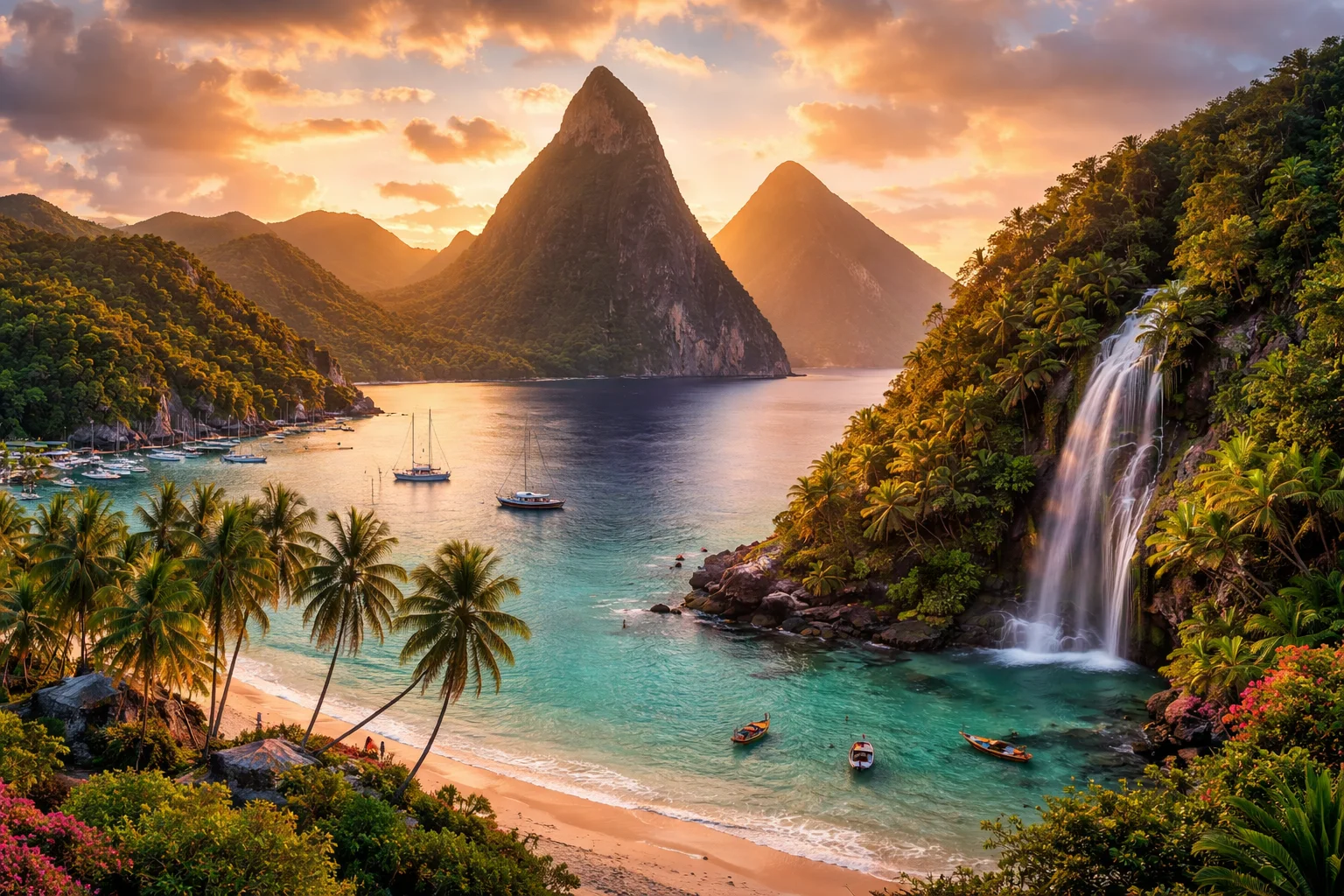
Saint Lucia overview
Saint Lucia is a sovereign island nation in the eastern Caribbean that combines a compact landmass with outsized ecological and cultural significance. Lying between larger neighbors, the country’s economy leans heavily on tourism and services while retaining smallholder agriculture and niche export production. Saint Lucia is distinctive for its Francophone creole heritage alongside English-language institutions, and for volcanic topography that concentrates biodiversity into steep, accessible zones. This overview highlights geography, culture, history, economy and major cities to orient readers to what makes Saint Lucia singular in the Lesser Antilles.
Common Geography Questions About Saint Lucia
Where Saint Lucia is located
Saint Lucia sits in the Lesser Antilles arc of the Caribbean Sea at roughly 13.9° N latitude and 61.0° W longitude. It occupies a single island between Martinique to the north and Saint Vincent and the Grenadines to the south; there are no land borders. The island faces the Caribbean Sea on its leeward west coast and the Atlantic Ocean to the windward east, and its maritime position places it near the Martinique Channel and the Saint Lucia Channel used for regional navigation. Saint Lucia’s location on the eastern Caribbean volcanic arc defines both its strategic maritime role and geological history.
Geography and landscape of Saint Lucia
Saint Lucia is a volcanic island with steep interior relief and narrow coastal plains. The island’s terrain includes the twin volcanic spires, Gros Piton and Petit Piton, and its highest point, Mount Gimie, rising from dense rainforest. Rivers are short and fast-flowing, cutting valleys toward the west coast; the windward eastern shore is rockier with surf, while the leeward west has sheltered bays. Sulphur Springs near Soufrière provides the unusual local feature of a geothermal, drive-in hot spring area. Climatic variation is marked: the island shows wetter windward rainfall and drier leeward microclimates that shape land use and settlement.
Saint Lucia culture and society
English is the official language in Saint Lucia, but a French-based creole (Kwéyòl) is widely spoken and institutionalized in music, media and school events. Cultural life retains visible French and West African layers: communal societies like La Rose and La Marguerite persist as organized, rival flower-society traditions that structure local festivals and pageantry. Christianity is predominant, with Roman Catholic influence evident in place names; Carnival, the Saint Lucia Jazz Festival and Kwéyòl music are prominent public expressions. The population is small and predominantly of African descent, with an outsized diaspora whose remittances and cultural ties shape domestic social patterns.
History of Saint Lucia
Saint Lucia’s human story moves from pre-Columbian Arawak and Carib habitation through intense colonial rivalry. The island was contested repeatedly by Britain and France—changing hands many times—and that prolonged tug-of-war left a layered legal, linguistic and land-tenure legacy. Plantation agriculture and enslaved labor dominated the colonial economy until emancipation reshaped rural settlement and labor patterns. In the 20th century Saint Lucia transitioned from colonial administration to internal self-government and eventual sovereignty; that arc positioned the island as both a former sugar economy and a modern service-oriented state in Caribbean regional politics.
Saint Lucia economy and government
Saint Lucia is a parliamentary democracy operating within a Westminster-derived constitutional framework: a ceremonial head of state is represented by a governor-general, while an elected prime minister leads government from the lower chamber alongside an appointed upper chamber. The national currency is the Eastern Caribbean dollar, and the country participates in regional economic institutions. The economy centers on tourism and hospitality, supplemented by agriculture—historically bananas, now diversified to cocoa and other crops—and financial and offshore services. Trade preferences and agricultural restructuring have repeatedly reshaped Saint Lucia’s export profile and labor markets.
Regions and major cities of Saint Lucia
Administratively, Saint Lucia is divided into 11 traditional quarters rather than provinces, a local subdivision system retained from colonial practice and still important for identity and land records. Castries is the capital and primary port and commercial center; Soufrière is a small town notable for its proximity to volcanic terrain and thermal features; Vieux Fort marks the island’s southern transport gateway and airport region. Rodney Bay and Gros Islet function as a tourism cluster on the northwestern coast. These population centers reflect a geographic split: a relatively urbanized northwest contrasted with agricultural and fishing communities elsewhere.
Distinctive characteristics of Saint Lucia
Saint Lucia is associated globally with several concrete features: its endemic Saint Lucia amazon parrot (Amazona versicolor) has been the focus of intensive conservation programs; the island was named for Saint Lucy, making it one of the few sovereign states bearing a female saint’s name; and its compact, volcanic topography supports boutique eco-tourism models. The country is a member of CARICOM and the Organisation of Eastern Caribbean States, giving it an outsized voice on regional policy for its size. These specific combinations of endemic species, linguistic creole persistence and institutional affiliations form Saint Lucia’s notable international profile.