Madagascar Guide
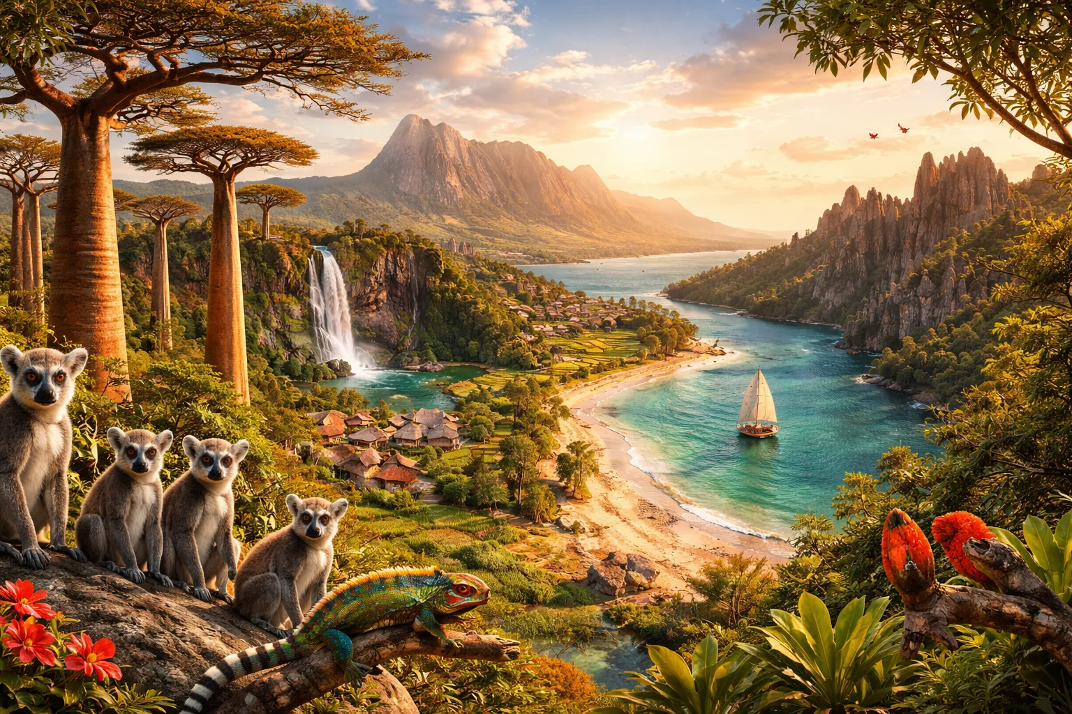
Madagascar overview
Madagascar is an island nation off the southeast coast of Africa and the world’s fourth-largest island. Its significance lies in a long biogeographic isolation that produced exceptionally high levels of endemism: roughly 90% of its wildlife is found nowhere else. The island combines a central highland plateau, eastern rainforests, and southern spiny deserts in a single national territory. Madagascar’s economy historically hinges on distinctive commodities such as vanilla and its cultural identity includes Austronesian-derived Malagasy language and unique funerary customs.
Common Geography Questions About Madagascar
Where Madagascar is located
Madagascar lies in the western Indian Ocean, east of Mozambique, occupying most of the large island centered near about 20°S latitude and 47°E longitude. Unlike most countries, Madagascar has no land borders; its nearest continental neighbor across the Mozambique Channel is Mozambique, approximately 400 kilometers to the west at the shortest distance. Major surrounding waters are the Mozambique Channel to the west and the broader Indian Ocean to the east and south. Its insular position shapes oceanic influences on climate and long-term biogeography.
Geography and landscape of Madagascar
Madagascar’s geography includes a central highland plateau, the rugged Tsaratanana Massif with Maromokotro as the island’s highest peak, and coastal plains fringed by mangroves. The island displays clear zonation: humid, orographic rainforests on the windward east; seasonally dry deciduous forests in the west; and the thorny, drought-adapted spiny forests and limestone karst “tsingy” outcrops in the south and west. Rivers such as the Betsiboka drain red-silted soils into estuaries. These landscapes, especially the tsingy formations and southern spiny desert, are geographically distinctive features seldom found together within a single country.
Madagascar culture and society
The Malagasy language, an Austronesian tongue related to languages of Borneo, is spoken nationwide alongside French in many formal domains. Society comprises multiple ethnic groupings—Merina, Betsimisaraka, Sakalava and others—with lineages traced through kinship and clan. A specific cultural practice is famadihana, the periodic “turning of the bones” funerary ceremony that revives ancestor veneration in communal memory. Christianity is widespread and frequently interwoven with traditional beliefs about ancestors. Demographically, rural subsistence rice farming remains pervasive and shapes everyday social organization and settlement patterns in ways unique to Madagascar.
History of Madagascar
Madagascar’s human history features an uncommon origin story: initial settlers arrived from Southeast Asia (Austronesian sailors) and later African and Arab migrants, producing a mixed Malagasy population. Indigenous polities evolved into highland kingdoms—most notably the Merina state that consolidated power in the 19th century—before French colonization transformed political structures by the late 1800s. Independence in the mid-20th century reopened national sovereignty, but the island’s historical significance is often framed by its biological isolation: its flora and fauna developed independently for tens of millions of years, making the island a living archive of evolutionary history.
Madagascar economy and government
Madagascar operates under a republican system with an executive-led national government and historically alternating strong presidential and prime ministerial roles; administration is decentralized into regional authorities. The economy combines subsistence agriculture, cash crops, mining and growing services. Madagascar has been a major global source of vanilla, cloves and lychees, and hosts extractive operations for minerals like ilmenite and graphite. The national currency is the Malagasy ariary. Structural features—high rural employment, commodity-weighted exports and tourism tied to unique biodiversity—shape the country’s economic profile in distinctive ways.
Regions and major cities of Madagascar
Administratively, Madagascar is divided into regions (faritra) used for governance and development planning; these subdivisions reflect both geography and historical kingdoms. The capital, Antananarivo, sits on the central highland plateau and functions as the political, cultural and transport hub. Major cities include Toamasina, the principal east-coast port handling oceanic trade, and Mahajanga on the northwest coast, known for its distinct coastal culture and mangrove hinterlands. Other urban centers like Fianarantsoa are regional nodes for agriculture and highland trade. These cities anchor the island’s spatially uneven development.
Distinctive characteristics of Madagascar
Madagascar is globally associated with endemic lemurs, multiple baobab species (notably the Avenue of the Baobabs), and the surreal karst of the Tsingy de Bemaraha—concrete symbols used internationally to represent biodiversity hotspots. The island’s vanilla production and the Malagasy language’s Austronesian roots also provide unmistakable global signatures. Conservation biology and evolutionary research frequently cite Madagascar because its prolonged isolation has produced species and ecosystems crucial to studies of speciation and endemism, giving the country a scientific and conservation profile distinct from most other nations.
Places in Madagascar
Amber Mountain
Amber Mountain is a volcanic massif and protected area in northern Madagascar known for its montane rainforest and endemic biodiversity. The site encompasses the Montagne d'Ambre National Park, a formally designated protected area covering about 18,200 hectares. Amber Mountain is significant for its status as an ecological island of humid forest within a largely dry region, and it serves as a reference site for studies of Malagasy endemism, forest ecology, and conservation management.
Andasibe-Mantadia
Andasibe-Mantadia is a protected rainforest complex in eastern Madagascar that combines Mantadia National Park and adjacent reserves. Its location within the island's eastern humid corridor contributes to high biological diversity and research value. The site supports the indri, Madagascar's largest lemur, and hosts more than eleven distinct lemur species recorded in the reserve system. The significance of Andasibe-Mantadia lies in its role as a long-term reference area for primate behavior, biodiversity inventories, and conservation science.
Antananarivo
Antananarivo is the capital city of Madagascar, located in the island's central highlands and serving as the country's political and economic center. The city sits at approximately 1,280 meters above sea level and functions as the national seat of government and major urban agglomeration. Antananarivo's significance derives from its role as Madagascar's administrative headquarters, its concentration of national institutions, and its historic royal precincts that anchor Malagasy national identity.
Avenue of the Baobabs
Avenue of the Baobabs is a prominent stand of large Adansonia grandidieri baobab trees located in western Madagascar near the town of Morondava. It is significant as an emblematic natural landmark and a focal point for botanical interest in Madagascar’s endemic flora. The trees at the site commonly reach heights up to about 30 meters and display trunk diameters that often exceed five meters, marking a measurable example of mature baobab growth.
Isalo National Park
Isalo National Park is a protected sandstone massif and national park in south-central Madagascar, noted for deep canyons and endemic wildlife. The park covers about 815 square kilometers and contains a mosaic of sandstone plateaus, riverine galleries, and isolated palm oases. It is significant for its geological exposures, high levels of plant and lemur endemism, and sustained scientific interest in Malagasy biogeography and conservation of dryland systems.
Lake Tritriva
Lake Tritriva is a near-circular crater lake in Madagascar's central highlands, notable for its steep crater walls and distinctive basin morphology. It lies within the Ankaratra volcanic massif and holds geological and cultural significance for the region. The presence of a closed crater basin classifies it as a crater lake in geomorphological terms. Lake Tritriva functions as a distinct geomorphic feature used in regional geological studies and local oral traditions.
Nosy Be
Nosy Be is an island off the northwest coast of Madagascar and the largest landmass in a nearby archipelago. It lies at approximately 13.3°S, 48.3°E, providing a precise geographic reference for mapping and scientific study. The island is significant for its concentrated marine and terrestrial biodiversity and for the production of aromatic agricultural crops. Nosy Be functions as a regional ecological node whose long-term importance arises from its biological resources and its role in local economic and cultural systems.
Ranomafana
Ranomafana is a village and adjoining rainforest area in southeastern Madagascar known for exceptional biodiversity and conservation importance. The name means "hot water" in Malagasy and references local thermal springs, a concrete geographic feature. Ranomafana is the focal area for Ranomafana National Park, which hosts multiple endemic mammal species and long-term scientific research programs that have documented species discovery and population data. This combination of biological discovery and formal protection defines its significance.
Tsimbazaza Zoo
Tsimbazaza Zoo is a zoological park in Madagascar, located in the capital city of Antananarivo. It serves as Madagascar's principal national zoological collection and contains an on-site natural history museum and botanical plots within its grounds. The site functions as a curated living collection of Malagasy fauna, with institutional responsibility for public animal holdings and parts of the country's documented specimen archive. This formal role distinguishes it within Madagascar's network of protected areas.
Tsingy de Bemaraha
Tsingy de Bemaraha is a limestone karst region and protected area on the western coast of Madagascar noted for its razor-sharp pinnacles and endemic biodiversity. The site encompasses a complex of pinnacles, canyons, and caves across roughly 150,000 hectares and includes both a strict nature reserve and an associated national park. Tsingy de Bemaraha is significant for its exceptional karst geomorphology and high rates of species endemism that are important to geology and conservation science.
University of Antananarivo
University of Antananarivo is the principal public university of Madagascar. It is located in Antananarivo and functions as the nation’s flagship higher-education and research institution, formally organized as a state university. The University of Antananarivo hosts multiple faculties and research units that supply degree programs across humanities, sciences, law, and professional fields, and it maintains a central library collection recognized for supporting national scholarship. The institution’s role as the primary university in the capital makes it a key node in Madagascar’s higher-education system.
Explore Natural Landmarks in Madagascar
Browse islands and mountains connected with Madagascar to keep exploring related geography clusters.