Kyrgyzstan Guide
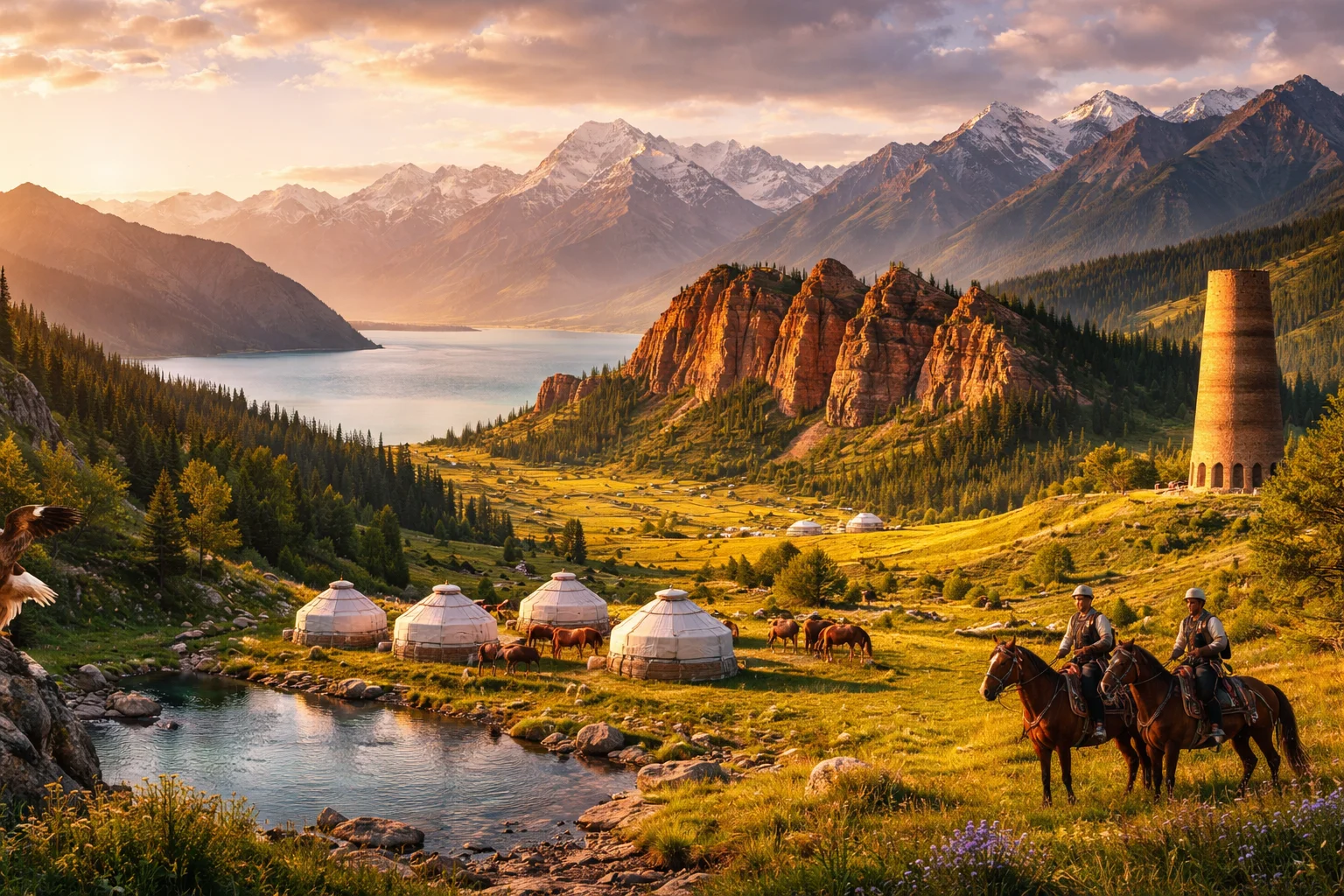
Kyrgyzstan overview
Kyrgyzstan is a landlocked, mountainous republic in Central Asia defined by high ranges, nomadic cultural continuity, and a post‑Soviet political trajectory. Straddling the Tien Shan mountains, Kyrgyzstan connects Chinese, Russian and Turkic cultural and economic zones while preserving distinct practices such as the epic of Manas and alpine saline Issyk‑Kul. Its small population contrasts with outsized pastoralism and seasonal migration patterns. For readers interested in geography, culture, history, economy and major cities, Kyrgyzstan combines alpine geography and living nomadic traditions that set it apart in the region.
Common Geography Questions About Kyrgyzstan
Where Kyrgyzstan is located
Kyrgyzstan sits in the heart of Central Asia on the Asian continent, roughly centered near 41°N latitude and 75°E longitude. It is bordered to the north by Kazakhstan, to the west and southwest by Uzbekistan, to the south by Tajikistan, and to the east by China; no coastline touches its borders. The country’s location is defined by interior basins and the transnational Tien Shan range; Lake Issyk‑Kul, an inland saline alpine lake that does not freeze seasonally, is a major body of water anchoring Kyrgyzstan’s eastern flank and regional identity.
Geography and landscape of Kyrgyzstan
Kyrgyzstan’s geography is dominated by the Tien Shan, a rugged mountain system that occupies much of the country and produces active glaciation, deep alpine valleys and high plateaus. The nation’s landscape includes alpine meadows used for seasonal pastures, intermontane basins, and the unique Issyk‑Kul basin: a saline, high‑altitude lake surrounded by peaks. Rivers such as the Naryn, which feeds the Syr Darya, carve narrow gorges ideal for hydropower. Climatic zones range from continental mountain tundra to dry foothills; the persistence of yurt pastures at high elevations is a geographic-cultural feature uncommon elsewhere.
Kyrgyzstan culture and society
Kyrgyzstan’s culture blends Turkic nomadic heritage with Russian and Islamic influences; Kyrgyz and Russian are the primary languages in everyday life and governance. Distinctive practices include the recitation of the Manas epic by oral storytellers, mounted games like kok‑boru (goat carcass polo), and eagle falconry among mountain communities. Islam is the dominant religion in form and ritual, yet local syncretic customs and clan networks remain strong. Demographically, urban migration has risen but rural pastoral households still shape social organization; the symbolic tunduk (yurt crown) appears on the national flag and signals living nomadic forms.
History of Kyrgyzstan
Kyrgyzstan’s history threads Altaic nomadic confederations, Silk Road intersections and several imperial incorporations into a distinct national narrative. Early Turkic and Kyrgyz tribal identities crystallized in the highland steppes; later centuries saw Mongol and then Russian imperial incorporation. In the twentieth century the territory became a Soviet republic, a period that built infrastructure, bilingual education, and centralized industries such as mining and agriculture. Independence in 1991 redirected Kyrgyzstan toward market reforms and state‑building while its mountainous interior retained pastoral lifeways, making the country a notable post‑Soviet experiment in pluralism and regional connectivity.
Kyrgyzstan economy and government
Kyrgyzstan is a unitary republic with a national assembly, the Jogorku Kenesh, and an executive presidency; the balance between parliamentary and presidential powers has shifted as part of its post‑Soviet constitutional evolution. Economically, industrial extraction—most notably the Kumtor gold mine—remains a major source of export earnings, alongside livestock, wheat, and hydropower potential from fast mountain rivers. The national currency is the som. Labor migration and remittances have become structural components of the economy. Policy debates frequently center on resource governance in mountain environments and decentralization to regional authorities.
Regions and major cities of Kyrgyzstan
Administratively, Kyrgyzstan is divided into several oblasts (regions) plus two cities of republican significance; this regional structure clusters around major basins and mountain corridors. The capital, Bishkek, is the political and economic center and seat of government. Osh, Kyrgyzstan’s second city, sits in the Fergana Valley and is notable for the sacred Suleiman‑Too massif that predates modern borders. Other important urban centers include Jalal‑Abad and Karakol, each serving as regional hubs for trade, mountain tourism, and agricultural processing. The country’s regional divisions mirror ecological zones rather than uniform population density.
Distinctive characteristics of Kyrgyzstan
Kyrgyzstan is globally associated with several concrete, verifiable features: Issyk‑Kul, a saline high‑altitude lake that remains ice‑free seasonally; the Manas epic as a living oral tradition; and kok‑boru, a mounted sport with national prominence. The tunduk motif on the national flag visually links state identity to yurt architecture. In global markets, Kyrgyzstan is known for the Kumtor gold deposit’s outsized role in exports. Its mountainous terrain makes it a focal point for Central Asian alpine hydrology studies and for conservation efforts tied to Tien Shan glaciers—specific attributes that distinguish Kyrgyzstan in regional and academic discussions.
Places in Kyrgyzstan
Ala Archa National Park
Ala Archa National Park is a state-designated national park in Kyrgyzstan that protects a prominent alpine gorge and associated mountain ecosystems. The park lies within the Kyrgyz Ala-Too range of the Tian Shan and is significant for its concentrated examples of high-mountain geology, hydrology, and biodiversity. The park holds formally protected status under national conservation law and encompasses clearly defined protected zones established to conserve landscape and ecological values.
Altyn Arashan
Altyn Arashan is a mountain valley and thermal spring area in the Terskey Alatau subrange of the Tian Shan in Kyrgyzstan. It lies within Issyk-Kul Region and is significant for its concentrated hot springs, alpine meadows, and glacial landforms. The valley is formally mapped in Kyrgyz national topographic surveys and appears in scientific literature on Central Asian alpine ecosystems. Its combination of thermal features and high-altitude terrain defines its regional importance.
Arslanbob Forest
Arslanbob Forest is a large natural walnut-fruit forest in Jalal-Abad Region of Kyrgyzstan, noted for its extensive Juglans regia stands. The forest is widely cited as one of the largest walnut groves in the world and covers an area reported at roughly eleven thousand hectares. Its significance stems from concentrated genetic diversity of walnut trees, long-established local management systems, and its role in regional agroforestry and biodiversity studies.
Bishkek
Bishkek is the capital city of Kyrgyzstan and its largest urban center, located in the country’s northern region. It functions as the political, economic, and cultural hub and contains the principal national government institutions. The city has a metropolitan population of roughly one million residents and sits at an elevation near 800 meters above sea level. Its formal status as the national capital shapes administrative organization across the republic.
Burana Tower
Burana Tower is a medieval brick minaret located within the Burana archaeological complex in northern Kyrgyzstan, notable for its archaeological and architectural importance. The structure currently stands at approximately 24 metres in height, a measurable attribute used in comparative studies of Central Asian minarets. It represents one of the surviving monuments associated with the medieval city of Balasagun. Its measurable characteristics, construction techniques, and preserved context contribute to its regional significance for studies of Central Asian urbanism and material culture.
Issyk-Kul
Issyk-Kul is a large saline, endorheic lake in northeastern Kyrgyzstan and a prominent high-altitude basin. It is the country's largest lake and covers approximately 6,236 square kilometers, forming a major hydrological basin. The lake's depth exceeds 600 meters at its deepest point, giving it substantial volume compared with many mountain lakes. Issyk-Kul is significant for geological research, biodiversity studies, and regional cultural identity.
Issyk-Kul Lake
Issyk-Kul Lake is a large, saline, endorheic lake in northeastern Kyrgyzstan, notable for its high-altitude basin and regional influence. It occupies a tectonic depression in the Tian Shan mountains and covers approximately 6,236 square kilometres with a maximum recorded depth near 668 metres. The lake is significant for its geological size, long archaeological record along its shores, and its role as a focus of scientific study into alpine saline-lake systems.
Jeti Oguz
Jeti Oguz is a cluster of seven prominent red sandstone rock formations and an adjoining mountain valley in northeastern Kyrgyzstan. The place is located south of Lake Issyk-Kul on the Tien Shan foothills and has regional significance for its striking crimson cliffs and culturally embedded rock motifs. The site comprises seven main outcrops that form a measurable geomorphological ensemble. The valley floor lies at approximately 1,800 meters above sea level, providing elevation context for geological and ecological study.
Kyrgyz National University
Kyrgyz National University is a state higher-education institution in Kyrgyzstan, formally named Kyrgyz National University named after Jusup Balasagyn. The university functions as the country’s principal academic and research flagbearer, retaining national designation and a chartered role under the Kyrgyz Republic’s higher-education framework. The institution traces its institutional continuity to an early Soviet-era foundation and occupies a central urban campus in Bishkek that includes a main administrative building, multiple faculty blocks, and a central scientific library with organized collections.
Osh Bazaar
Osh Bazaar is a major traditional market in Bishkek, the capital city of Kyrgyzstan, specializing in wholesale and retail trade. The market hosts several hundred permanent stalls and numerous temporary vendors beneath covered arcades and open courtyards. It functions as a primary urban supply center for fresh produce, dried fruits, textiles, and household goods, linking rural producers with city consumers. The scale of Osh Bazaar and its continuous commercial role make it one of Kyrgyzstan's most prominent marketplaces.
Sary-Chelek Biosphere Reserve
Sary-Chelek Biosphere Reserve is a protected mountain reserve in western Kyrgyzstan centered on a chain of glacial lakes. It lies within the western Tian Shan mountain system and conserves extensive high-altitude forest and alpine meadow ecosystems. The reserve covers approximately 23,900 hectares, providing habitat for regionally important flora and fauna and serving as a living laboratory for mountain ecology and conservation science. Its combination of intact watersheds and relict forests gives it national and international significance.
Song Kol Lake
Song Kol Lake is an alpine freshwater lake in central Kyrgyzstan, known for its high-elevation plateau setting and pastoral landscape. The lake sits within the mountainous interior of Kyrgyzstan and reaches roughly 3,016 meters above sea level, a concrete topographic datum used in geographic descriptions. Song Kol Lake is significant as a large high‑altitude basin that combines ecological importance for waterfowl and long-standing pastoral use by local herding communities.