Capital of Guatemala, Location & Geography Facts
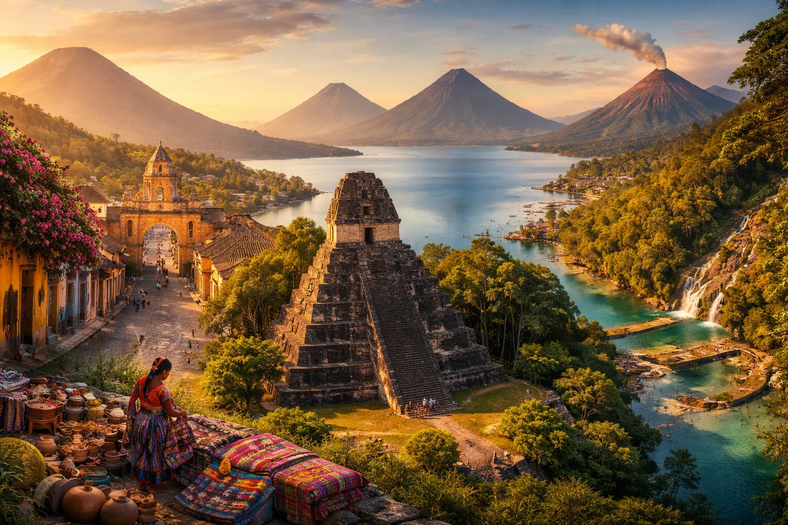
Short answer
What is the capital of Guatemala?
The capital of Guatemala is Guatemala City.
Guatemala is located in Central America and has a geography of volcanic highlands, Pacific and Caribbean coastal areas, rainforests, lakes, and Maya heritage landscapes.
Capital: Guatemala City
Location: Central America
Borders: Mexico, Belize, Honduras, and El Salvador
Coasts: Pacific Ocean and Caribbean Sea
Landscape: Volcanic highlands, lowlands, lakes, forests, and coastlines
Guatemala overview
Guatemala is a Central American country on the isthmus between Mexico and Honduras, notable for its highlands, dense indigenous presence, and a landscape shaped by more than thirty volcanoes. The nation combines extensive lowland rainforest in the north with volcanic highlands and coastal plains, producing sharp contrasts in climate, agriculture and settlement. Guatemala’s significance stems from its role as the core of the ancient Maya world, continued vibrancy of Maya languages and textiles, and an economy where coffee, cardamom and remittances have outsized influence on national life.
Common Geography Questions About Guatemala
Where Guatemala is located
Guatemala sits on the Central American isthmus of North America, roughly between 13° and 18° north latitude and 88° and 93° west longitude. It borders Mexico to the north and west, Belize to the northeast, Honduras to the east, and El Salvador to the southeast; its mainland touches both the Pacific Ocean on the southwest and the Gulf of Honduras (Caribbean Sea) on the east. The country’s geography is defined by the transition from Mesoamerican highlands to tropical lowland Petén, and by strategic coastlines that historically connected inland highland societies to maritime trade routes.
Geography and landscape of Guatemala
Guatemala’s geography moves quickly from volcanic highlands—the Sierra Madre de Chiapas and the Central Highlands—to the broad Maya lowlands of El Petén. Its highest point, Volcán Tajumulco, is the tallest mountain in Central America, while the Motagua and Usumacinta rivers carve major drainage corridors; the Usumacinta also forms part of the international border with Mexico. The country hosts more than thirty volcanoes, including well-studied cones like Pacaya and Fuego, and a distinctive caldera lake system such as Lake Atitlán surrounded by steep volcanic walls. Climatic zones range from humid tropical coasts to temperate highland valleys used for coffee production.
Guatemala culture and society
Guatemala’s culture feels discrete in its everyday visibility of indigenous traditions: dozens of distinct Maya languages continue in routine use alongside Spanish, and regional textile patterns—huipiles and cortes—act as village identity markers more than fashion. Catholic and Evangelical Christianity coexist with persistent Maya ritual practices, producing locally specific syncretisms such as community processions and ritual offerings at agricultural milestones. Demographically, large rural highland communities maintain communal landholding patterns and extended kin networks; the country has one of the highest proportions of indigenous population in the Americas, shaping social norms, festivals and municipal governance in many departments.
History of Guatemala
Guatemala’s history centers on the rise, florescence and transformation of the Maya civilization—classic urban centers such as Tikal redefined pre-Columbian urbanism in the Americas. Spanish conquest in the early 16th century subordinated those highland polities into the Captaincy General of Guatemala under New Spain, remaking land tenure and labor for centuries. Independence from Spain came in 1821, followed by 19th-century liberal reforms that oriented the economy toward export crops like coffee and introduced large-scale land consolidation. The 20th century saw repeated political upheavals, foreign interventions and a prolonged internal armed conflict that ended with peace accords in the 1990s, after which efforts at democratic consolidation and reconciliation have continued.
Guatemala economy and government
Guatemala is governed as a presidential republic with a directly elected president, a unicameral Congress, and a judicial branch; municipal governments exercise local administration within 22 departments. The economy combines export agriculture—coffee, sugar, bananas and notably cardamom—with a large informal domestic sector and significant labor migration; remittances from abroad constitute a major source of foreign income relative to many regional peers. The national currency is the quetzal, named after the country’s emblematic bird. Industrial activity concentrates on food processing, textiles and maquila operations, while land inequality and rural poverty remain persistent structural features.
Regions and major cities of Guatemala
Administratively Guatemala is divided into 22 departments that reflect geographic contrasts: the highland Western Highlands, the southern Pacific plain, and the vast northern department of El Petén. The capital, Guatemala City, is the country’s largest urban agglomeration and economic hub; Quetzaltenango (Xela) serves as the principal city of the western highlands and a cultural-educational center. Antigua Guatemala, the colonial-era capital, preserves Spanish-Baroque architecture and functions as a cultural reference point. Puerto Barrios and other Caribbean ports mark the country’s Atlantic-facing logistics corridors, contrasting sharply with highland market towns.
Distinctive characteristics of Guatemala
Guatemala is globally associated with the Maya archaeological corpus—Tikal and other Classic-period sites are central to Mesoamerican archaeology—and with richly patterned textile traditions where individual villages maintain identifiable motifs. The nation is a leading global producer of cardamom and a recognized origin for specialty coffee grown on volcanic slopes. Its national currency and national bird share the name quetzal, a symbol that recurs in art and identity. Conservation efforts in the Maya Biosphere Reserve and unique volcanic landscapes also make Guatemala a recurring subject in biodiversity and volcanology studies.
Places in Guatemala
Antigua Guatemala
Antigua Guatemala is a historic city in Guatemala's central highlands defined by extensive Spanish colonial architecture and formal urban planning. It served as the principal administrative center of colonial Guatemala and preserves numerous civic and ecclesiastical ruins from that era. The city lies at approximately 1,530 meters above sea level, a measurable fact that influenced building techniques and urban form. Antigua Guatemala is significant for its concentration of preserved Baroque structures and accumulated archaeological evidence.
Chichicastenango Market
Chichicastenango Market is a large indigenous open-air market in the town of Chichicastenango, Guatemala, renowned for its concentration of K'iche' Maya vendors and traditional crafts. It occupies the town's central plaza and surrounding streets and operates primarily on Thursdays and Sundays. The market serves as a measurable commercial hub with hundreds of stalls and artisans selling textiles, masks, pottery, and ceremonial objects, making it one of Guatemala's most prominent artisan markets.
Guatemala City
Guatemala City is located in Guatemala, in the country’s south-central highlands. It is Guatemala’s capital and largest city and its main political and economic center, housing national government institutions and a concentration of commercial, administrative, and cultural activity. Approximately one million people live within the municipality, while the broader urban agglomeration has more than three million residents.
La Aurora Zoo
La Aurora Zoo is a municipal zoological park in Guatemala, located in Zone 13 of Guatemala City. The site occupies municipal parkland adjacent to La Aurora International Airport and functions as the principal public zoological collection administered by the municipal government. Its formal status as a city-operated zoological institution defines its role in urban conservation, species display, and institutional education within Guatemala's capital urban fabric.
Lake Atitlán
Lake Atitlán is a freshwater lake in western Guatemala's Guatemalan Highlands. It occupies a volcanic caldera, with the cones of Volcán Atitlán, Volcán Tolimán, and Volcán San Pedro rising from the basin rim. The lake supports multiple indigenous towns and is noted for its deep basin: its surface sits at approximately 1,562 meters above sea level, and it reaches a maximum depth of about արթ340 meters.
Livingston
Livingston is a coastal town and settlement on Guatemala’s Caribbean shore in the Izabal department, noted for its distinct Afro-indigenous culture. It occupies a defined geographic position at the mouth of the Río Dulce where that river flows into Amatique Bay, and its coordinates are approximately 15.85°N, 88.73°W. The town functions as a local maritime node and cultural center, combining human settlement, coastal ecosystems, and long-standing community traditions that contribute to its regional significance.
Pacaya Volcano
Pacaya Volcano is an active volcanic complex in south-central Guatemala noted for frequent basaltic eruptions and persistent lava flow activity. It reaches an elevation of 2,552 meters above sea level and forms part of the Central American Volcanic Arc. The volcano has modern scientific significance for the study of open-vent eruption dynamics and hazard assessment, and it has long held cultural importance for nearby communities and regional history.
Popol Vuh Museum
Popol Vuh Museum is a museum in Guatemala City, Guatemala, focused on pre-Columbian and colonial-era material culture. It is located on the campus of Universidad Francisco Marroquín in the capital and serves as a university-affiliated institution holding collections used for research and teaching. The museum is formally presented as a curated repository of Maya and other Central American artifacts and related colonial religious art.
Quetzaltenango
Quetzaltenango is a city in western Guatemala that serves as the departmental seat and the largest urban center of the Guatemalan highlands. It is the country’s second-largest city and lies at about 2,330 meters elevation, a formally defined highland setting. Quetzaltenango is significant as a regional economic and cultural hub with sustained indigenous presence and well-preserved civic architecture that has influenced urban development across western Guatemala.
Rio Dulce
Rio Dulce is a river corridor in eastern Guatemala that links Lake Izabal to the Gulf of Honduras. It is about 43 kilometers long between the lake outlet and the Caribbean coastal inlet, making it one of the country's principal freshwater channels. The corridor includes lowland wetlands and the riverside settlement commonly called Fronteras. Rio Dulce is significant for regional ecology, historic fortifications, and inland–coastal hydrologic connectivity.
Santa María Volcano
Rising about 3,772 meters above sea level, Santa María is a large stratovolcano in western Guatemala. A major Plinian eruption in 1902 removed much of its summit and spread tephra across the surrounding landscape. On the western flank, prolonged dome-building has formed the Santiaguito complex, one of the world’s most intensively studied lava-dome systems.
Semuc Champey
Semuc Champey is a natural limestone monument in the department of Alta Verapaz, Guatemala, defined by a stepped succession of turquoise pools atop a karst bridge. It lies within the Cahabón River watershed and is significant for its distinctive karst hydrology and cultural links to local Maya communities. The limestone bridge measures roughly 300 meters in length, forming a natural crossing where an underground river flows beneath the surface pools.
Frequently Asked Questions
What is the capital of Guatemala?
The capital of Guatemala is Guatemala City.
Where is Guatemala located?
Guatemala is located in Central America, south of Mexico.
What is Guatemala's geography like?
Guatemala has volcanic highlands, Pacific and Caribbean coastal areas, forests, lakes, and lowland regions.