Albania Guide
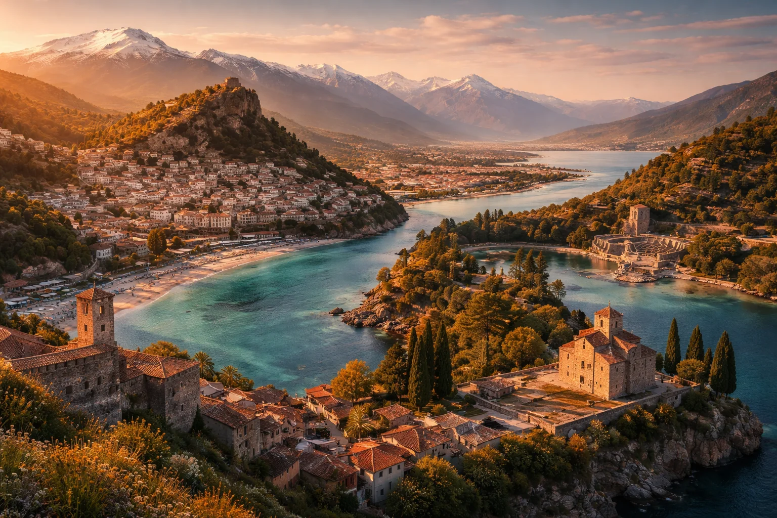
Albania overview
Albania is a sovereign state on the Balkan Peninsula in Southeastern Europe. It occupies a narrow coastal corridor between the Adriatic and Ionian Seas and carries a national identity strongly tied to the 15th‑century leader Skanderbeg and a red flag bearing a black double‑headed eagle. The country concentrates mountain ranges, ancient lake basins and a coastline within a relatively compact area, producing sharp regional contrasts in economy and settlement. These spatial compressions make Albania distinctive for rapid transitions from high alpine terrain to Mediterranean shorelines within short distances.
Common Geography Questions About Albania
Where Albania is located
Albania sits on the western flank of the Balkans at roughly 41°N, 20°E. It shares land borders with Montenegro to the northwest, Kosovo to the northeast, North Macedonia to the east and Greece to the south. Its western shores meet the Adriatic Sea and, farther south, the Ionian Sea; the Albanian coast faces Italy across the Strait of Otranto, the narrow maritime entrance to the Adriatic. That specific location has historically anchored Albania’s role in cross‑Adriatic trade and migration patterns distinct from interior Balkan states.
Geography and landscape of Albania
Albania’s terrain is predominantly mountainous, with the Albanian Alps (the Accursed Mountains) in the north and the Pindus‑Dinaric system through the interior and south. The Drin River system drains toward Lake Shkodër, while Lake Ohrid on the eastern boundary is one of Europe’s oldest and deepest lakes. Notably, the Vjosa River remains one of the continent’s few large, largely free‑flowing rivers, cutting through karst landscapes punctuated by springs such as the Blue Eye (Syri i Kaltër). Mount Korab, on the North Macedonian border, is Albania’s highest summit, giving sudden elevation shifts across short distances.
Albania culture and society
Albania’s main linguistic identity is Albanian, split into Gheg and Tosk dialect groups; the literary standard reflects the latter. A recognized Greek minority lives in the south, and Aromanian and Roma communities persist in enclaves. Religious life is plural: Sunni Islam, Christian Orthodox and Catholic communities coexist alongside the Bektashi Sufi order, whose world seat is located in Tirana—a configuration shaped by Ottoman-era conversions and later secularizing policies. Social customs retain distinctive elements such as the Kanun of Lekë Dukagjini in the northern highlands and the concept of besa, a culturally embedded pledge of honor and hospitality.
History of Albania
Albania’s historical arc runs from Illyrian tribal polities through Roman and Byzantine incorporation to long Ottoman rule, punctuated by the resistance led by Skanderbeg in the 15th century. Independence was proclaimed in 1912 after waning Ottoman control; the 20th century then produced monarchy, wartime occupations and a communist era under Enver Hoxha. That regime pursued ideological isolation and declared state atheism while implementing large national projects—most visibly a network of defensive bunkers—before collapsing in the early 1990s and initiating rapid political and economic transition.
Albania economy and government
Albania is organized as a parliamentary republic with a unicameral Assembly (Kuvendi); the president is head of state while executive power lies with the prime minister and cabinet. The modern economy mixes services—especially tourism along the coast—agriculture on coastal plains, and extractive industries inland. The country exploits significant mineral resources, including chromium and copper, and hosts Patos‑Marinza, one of Europe’s largest onshore oil fields. The national currency is the lek, and the economy is shaped by private sector expansion alongside capital flows from sizable emigrant communities.
Regions and major cities of Albania
Albania is administratively grouped into twelve counties, which encompass urban and rural municipalities for local governance. The capital, Tirana, is the political and economic center; Durrës functions as the principal Adriatic port; Vlorë sits on the southern coast where Albanian independence was declared in 1912. Inland centers such as Shkodër and Elbasan act as regional hubs. Two small historic towns—Berat and Gjirokastër—are renowned for their Ottoman‑era stone architecture and fortified houses and are inscribed on the UNESCO World Heritage list, each with locally recognized urban forms.
Distinctive characteristics of Albania
Albania is associated with several concrete global touchpoints. The 1908 Congress of Manastir established a Latin‑based alphabet that enabled modern Albanian literacy and national institutions. The Arbëreshë communities in southern Italy preserve a centuries‑long diaspora strand that links Albanian language and customs to the Italian peninsula. Southern Albanian iso‑polyphonic singing is internationally recognized as an intangible cultural heritage and exemplifies a musical style rooted in the region. Scholarly interest in Illyrian origins and Balkan linguistics also positions Albania as a focal area for research into Indo‑European language history.
Places in Albania
Berat
Berat is a historic city in south-central Albania notable for its well-preserved Ottoman-era urban fabric and hilltop fortress. Berat's compact core features multi-storied, whitewashed houses arranged on steep slopes above a river valley. The historic nucleus was inscribed on the UNESCO World Heritage List in 2008 for its architectural continuity and the coexistence of different religious traditions. The designation identifies a measurable protected ensemble of built heritage spanning several hectares within the town center.
Blue Eye
Blue Eye is a karst spring and natural pool in southern Albania known locally as Syri i Kaltër. It is a distinctive hydrological feature characterized by exceptionally clear, intensely blue water and a springhead whose depth exceeds fifty meters. The site is significant as a scientific subject for karst and hydrogeological study and as a prominent natural landmark in Albania’s landscape. Blue Eye’s visual clarity and color make it notable among regional spring systems.
Butrint
Butrint is an archaeological site and protected landscape in southern Albania that preserves multi-period urban remains. It occupies a coastal lagoon setting where archaeological layers record Greek, Roman, Byzantine, and later occupation. The site combines cultural monuments, wetland habitats, and standing architecture, and it holds formal recognition as a UNESCO World Heritage Site. Its defined boundaries include both the ancient settlement and adjacent protected territory under Albanian heritage frameworks.
Dhermi Beach
Dhermi Beach is a coastal beach and coastal zone on Albania’s Ionian coast known for its pebbly shoreline and cliffs. It sits on the Albanian Riviera and forms a coastal frontage of roughly two kilometers along the Ionian Sea. The site is significant for its combined natural seascape and adjacent traditional village settlement, and it contributes to regional identity, local fisheries, and nearshore marine habitats characteristic of the southern Albanian coastline.
Gjirokastër
Gjirokastër is a historic city in southern Albania notable for its well-preserved Ottoman-era stone architecture and prominent hilltop fortress. It functions as the administrative center of Gjirokastër County and retains a compact, largely intact urban core. The central settlement occupies steep slopes at approximately 300 meters above sea level. These physical and built characteristics establish Gjirokastër as an important reference point for studies of Balkan vernacular architecture and urban form.
Ksamil Beach
Ksamil Beach is a sandy coastal beach on the Ionian Sea in southern Albania, notable for its cluster of small offshore islands. The place lies on Albania’s southern shoreline near the archaeological zone of Butrint and the port town of Sarandë. Ksamil Beach has a measurable coastal composition that includes four principal islets immediately offshore and a series of sheltered shallow bays. Its significance derives from its coastal morphology and proximity to important heritage sites.
Llogara Pass
Llogara Pass is a mountain pass in southwestern Albania that forms a high coastal crossing of the Ceraunian Mountains. It sits on the ridge separating the Ionian coastline from inland valleys and has strategic and ecological significance for the region. The pass reaches an elevation of about 1,027 metres above sea level, providing a measurable high point on the coastal range. The location, history, significance, and distinctive features of the pass make it a widely cited geographic landmark.
Rozafa Castle
Rozafa Castle is a multi-period fortress located on a rocky hill near the city of Shkodër in northwestern Albania. The site crowns a limestone outcrop that rises about 130 meters above the surrounding plain. Rozafa Castle is significant for its long sequence of occupation and for its central role in Albanian cultural memory. The place combines strategic military function with a landmark status tied to an enduring local legend and layered archaeological remains.
Shkodra Lake
Shkodra Lake is a large freshwater lake straddling northern Albania and Montenegro, centered near the city of Shkodër. It is the largest lake in the Balkans by surface area, with extent varying approximately between 370 and 530 square kilometers. The lake is significant for its extensive wetlands, rich biodiversity, and long-standing cultural and economic roles in the region. Shkodra Lake supports complex ecosystems and has been a focal feature of regional geography and human settlement.
Tirana
Tirana is the capital and largest city of Albania, serving as the country’s political and administrative center. It functions as the primary hub for government, higher education, and major economic activity. The city is precisely located at coordinates 41.3275° N, 19.8187° E, which provides a formal geospatial reference. Its national significance derives from concentrated institutions of state, major cultural repositories, and its role as a focal point of modern urban development.
University of Tirana
University of Tirana is a public university in Albania and the principal higher-education institution based in the national capital. It was founded in 1957 and serves as the largest public university in Albania by enrollment and breadth of faculties. It comprises multiple faculties and research units delivering undergraduate, graduate, and doctoral programs across disciplines including law, economics, natural sciences, social sciences, and foreign languages. The institution functions as a central academic and research hub for Albanian-language higher education and as a primary generator of professional graduates for public administration, education, and the private sector.
Valbona Valley
Valbona Valley is a glacially carved mountain valley in northern Albania within the Albanian Alps, notable for steep relief and habitat diversity. The valley covers roughly 8,000 hectares, forming a clearly bounded geomorphological unit with measurable area and elevation gradients. Its significance lies in combined geological, ecological, and cultural values that support scientific study, species conservation, and the persistence of highland traditions in a compact mountain landscape.